🗺️ Global Flight Tracking
Real-time position, altitude, speed & complete flight path visualization
Industry-leading 2D & 3D interactive flight tracking systems — Real-time ADS-B integration, stunning terrain visualization, and fully customizable for any airline brand.
Icarus Flight Maps deliver the most engaging passenger experience in the industry with real-time 3D visualization, live ADS-B data integration, and stunning terrain rendering — all without requiring internet connectivity.
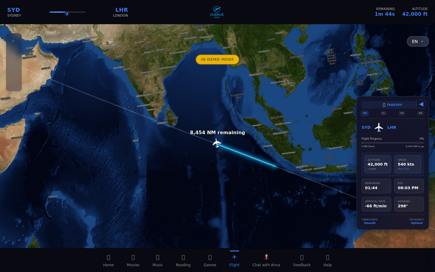
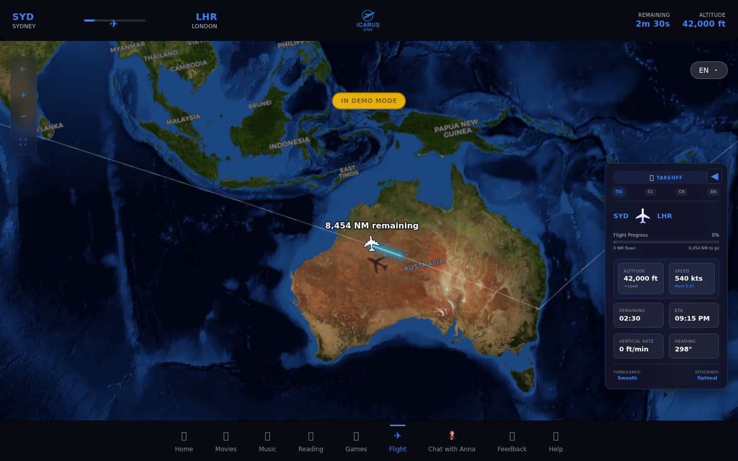
Classic, reliable flight tracking with real-time positioning and comprehensive flight data
Real-time position, altitude, speed & complete flight path visualization
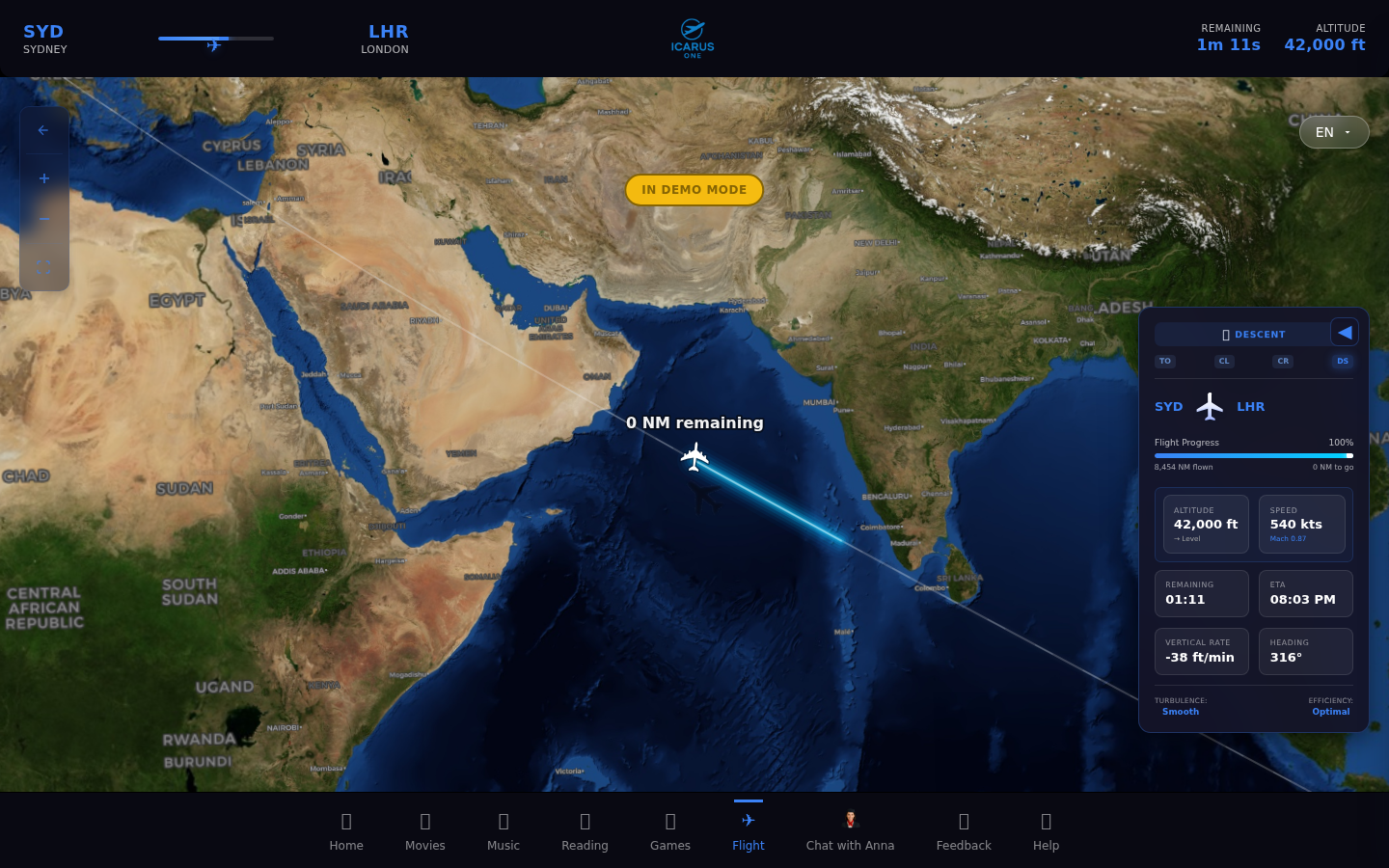
Zoomed terrain, waypoints, vertical rate & distance to destination
All data via onboard ADS-B transponder
Airline logos, colors & route highlights
Admin UI in 13 languages; passengers served in 30+ via Anna AI
Elevated perspective with terrain elevation rendering and enhanced visual depth
Enhanced depth perception with elevation-aware terrain visualization & mountain ranges

Angled perspective showing aircraft trajectory, waypoints & geographic landmarks
Isometric rendering for better spatial awareness
Real topographic data for accurate terrain
Seamless zoom between 2D and 3D views
Stunning photorealistic 3D terrain with full 360° rotation and cinematic camera views
Photorealistic Earth rendering with real-time satellite imagery and night lighting
Dynamic camera angles including cockpit view, chase cam, and orbital perspectives
High-resolution textures & lighting effects
Full camera control for any viewing angle
Smooth 60fps rendering on all devices
Advanced AI and location awareness capabilities integrated with our flight maps
Offline AI assistant responds to passenger queries about flight status, location, and destination — instant for common queries, 1-3 seconds for AI-generated answers — no internet required
3.4+ million geographic features worldwide — Anna identifies nearby cities, mountains, rivers, landmarks, and natural wonders in real-time
Anna runs on-device with no cloud dependencies
3.4M+ POIs including rivers, mountains, cities & landmarks
Passengers ask "Where are we?" and get instant answers
Real-time geographic markers with color-coded categories, click-for-details popups, and comprehensive admin controls
Color-coded markers for cities, capitals, landmarks, monuments, volcanoes, national parks, rivers, lakes, mountains, islands, seas, waterfalls, geysers, and hot springs
Click any POI marker to reveal detailed information including coordinates, importance rating, country, and distance from aircraft
Comprehensive control panel for customizing POI display, density, and update frequency to match your airline's preferences
POIs update dynamically based on aircraft location
Choose which categories to display and how many
Efficient clustering prevents map clutter
Realistic flight path calculation with actual airways, waypoints, and phase-based flight modeling
Uses actual airways and waypoints for authentic flight routing between any two airports worldwide
Accurate climb, cruise, and descent modeling with vertical rate calculations and ETA predictions
ICAO/IATA codes, coordinates & city names
Highly accurate position tracking
Simulation memory for consistent performance
Choose the deployment model that best fits your infrastructure and operational needs
Compare our technology and pricing against industry leaders
| Feature | 🚀 Icarus | Collins Airshow | Thales 3DMaps | Panasonic Arc |
|---|---|---|---|---|
| 3D Rendering | ✅ Photorealistic | ✅ Standard | ✅ Basic | ❌ 2D Only |
| Offline Operation | ✅ Full ADS-B | ⚠️ Limited | ❌ Requires WiFi | ❌ Requires WiFi |
| Deployment | Docker / Icarus One | Proprietary Hardware | Proprietary Hardware | Proprietary Hardware |
| Customization | Full API Access | Limited | Very Limited | Limited |
| License Cost | From $2K/aircraft | Est. $45K+/aircraft* | Est. $65K+/aircraft* | Est. $38K+/aircraft* |
Icarus: $100K for 50 aircraft | Competitors: Est. $1.9M - $3.25M for same fleet*
*Competitor pricing is estimated based on publicly available industry data and may vary by configuration, region, and contract terms.
Get detailed specifications, pricing, and see a live demo of Icarus Flight Maps in action.