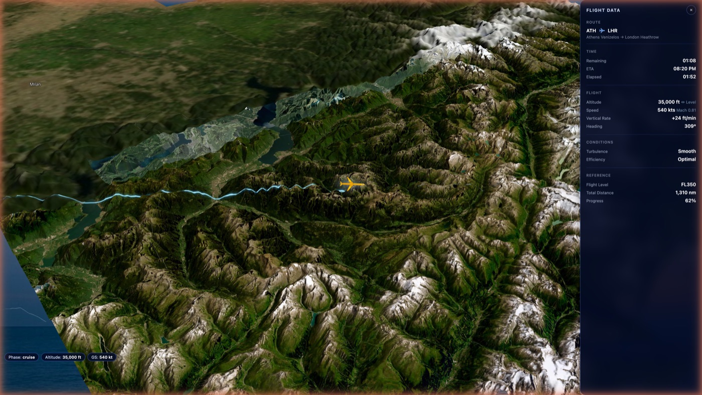
Flight Data Panel
Altitude, ground speed, heading, vertical rate, ETA, distance remaining — updated live from ADS-B.

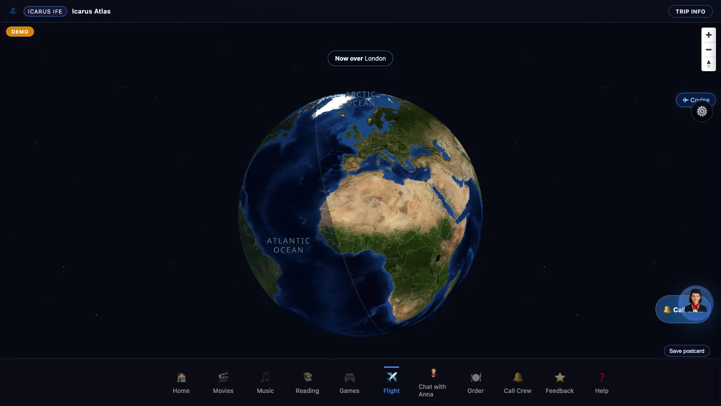
Included with every Icarus One system.
Your passengers see their flight in 3D satellite terrain.
Your competitors' passengers see a loading screen.
All portable. All offline. At a fraction of the cost of installed IFE.
Technical evaluators: Jump to full specifications and pricing →
Software captured on an anonymized synthetic demo route.
Every passenger picks their perspective. Follow behind the aircraft, look left over the Alps, or chase from above — all rendered on real satellite imagery.
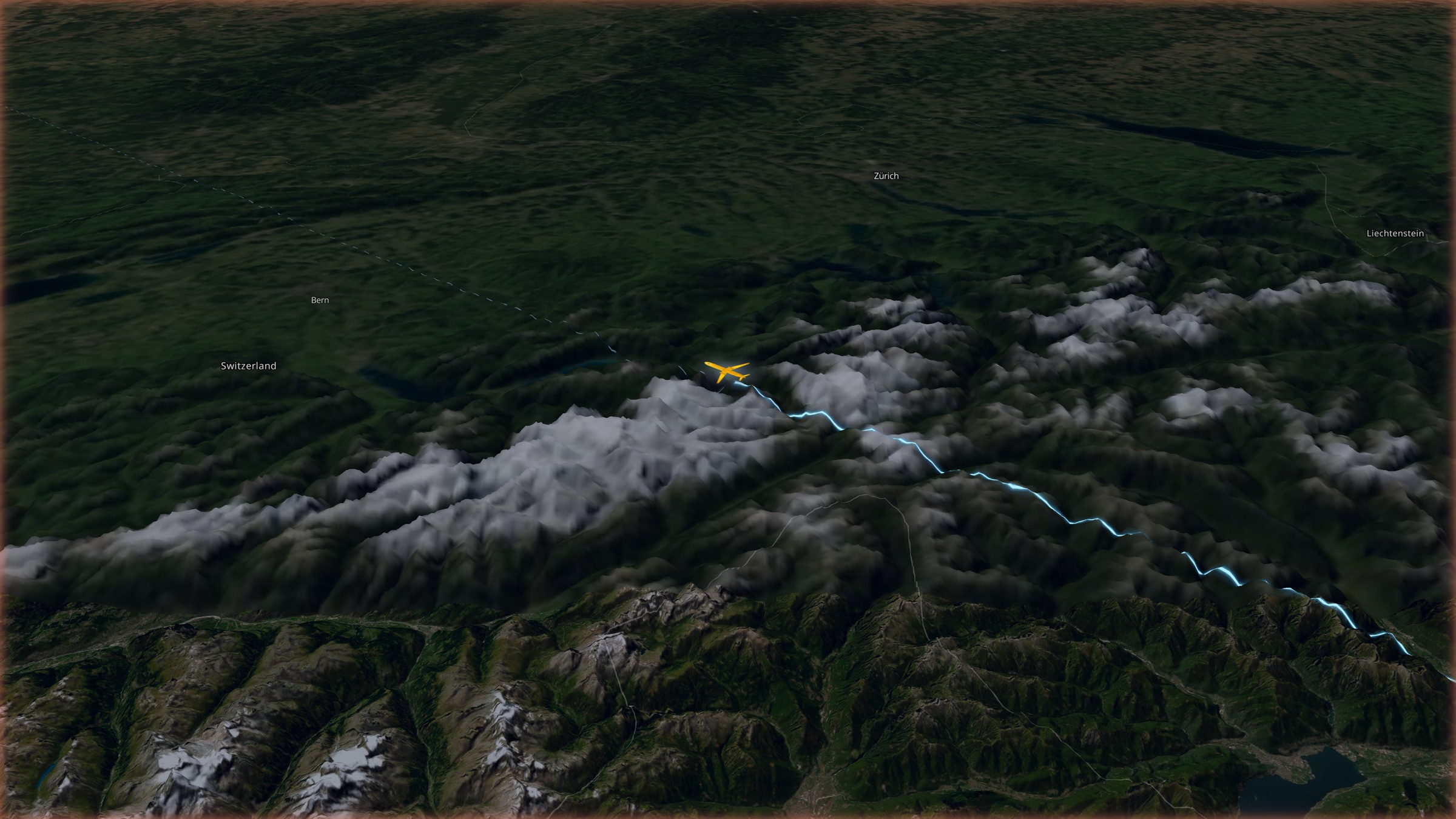
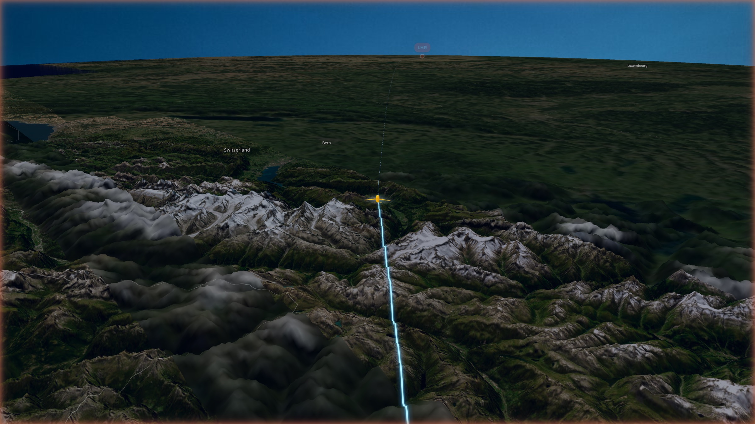
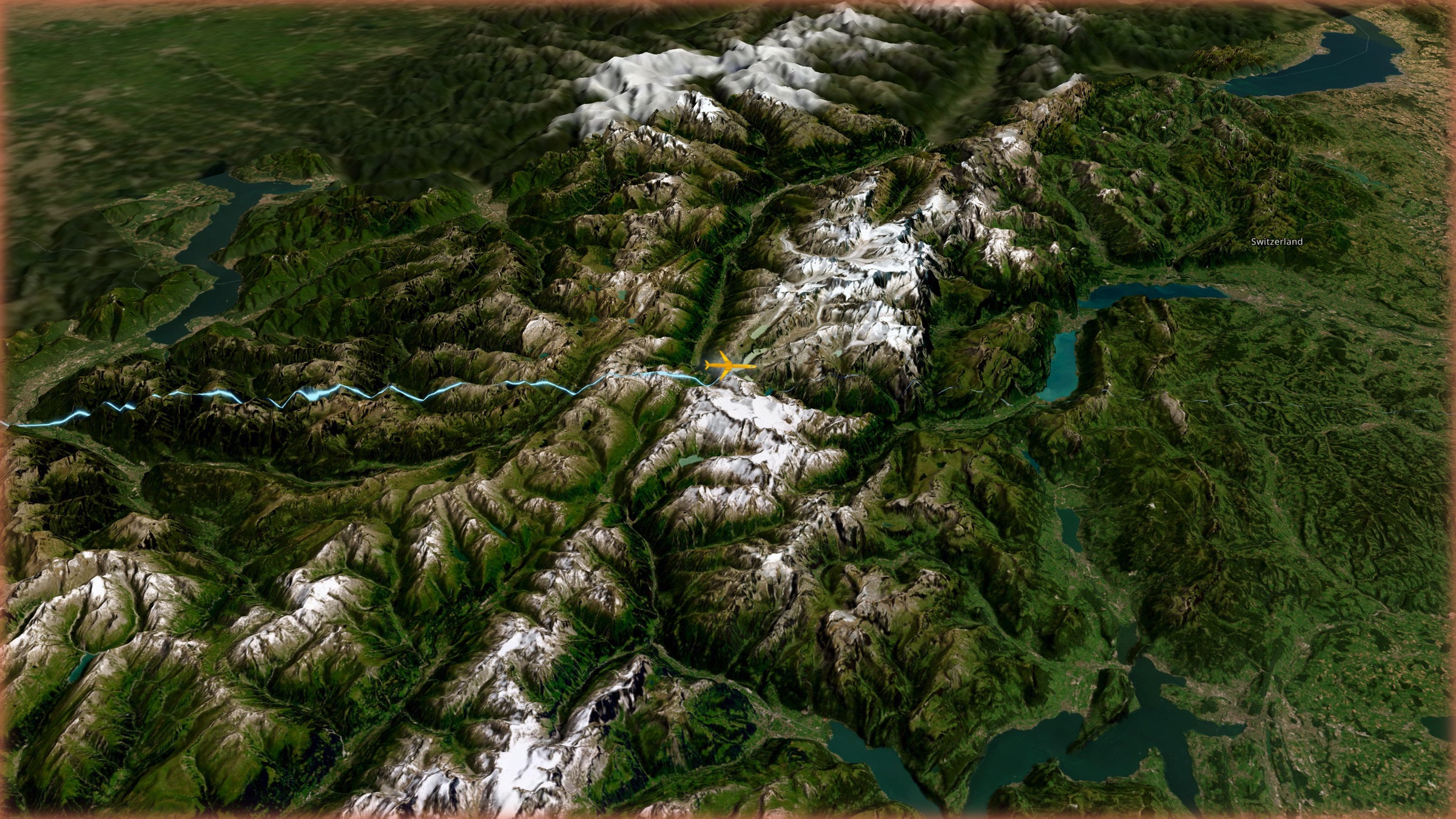
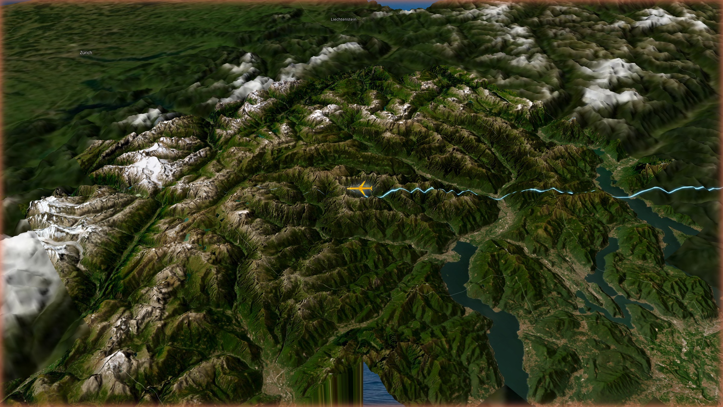
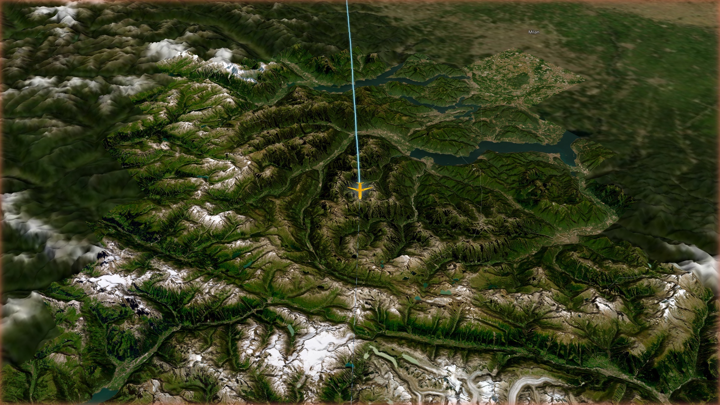
Live ADS-B transponder data drives every number — altitude, speed, heading, ETA. No internet required. Protected by U.S. Patent 10,193,945.
Altitude, ground speed, heading, vertical rate, ETA, distance remaining — updated live from ADS-B.
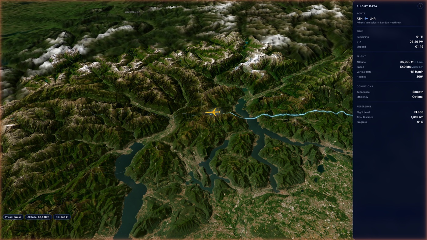
Passengers see exactly where they are — over which river, valley, or mountain range — updated every second.
All satellite tiles stored on-device. No internet needed at altitude.
Real aircraft data from an onboard receiver — not GPS simulation.
U.S. Patent 10,193,945 covers the core tracking system.
Atlas now adds useful, automatic context around the live map without requiring an internet connection.
Upcoming landmark cards appear along the route, including sunrise and sunset alerts.
A live location ticker identifies the current area beneath the aircraft.
Points of interest indicate whether passengers should look left or right.
Destination information appears automatically during descent.
Prayer times and approximate Qibla direction are calculated from the aircraft position.
Anna can move or focus the Atlas view when a passenger asks about the flight.
Full interface with navigation bar, flight progress, camera switcher, and entertainment access — all on their own device.
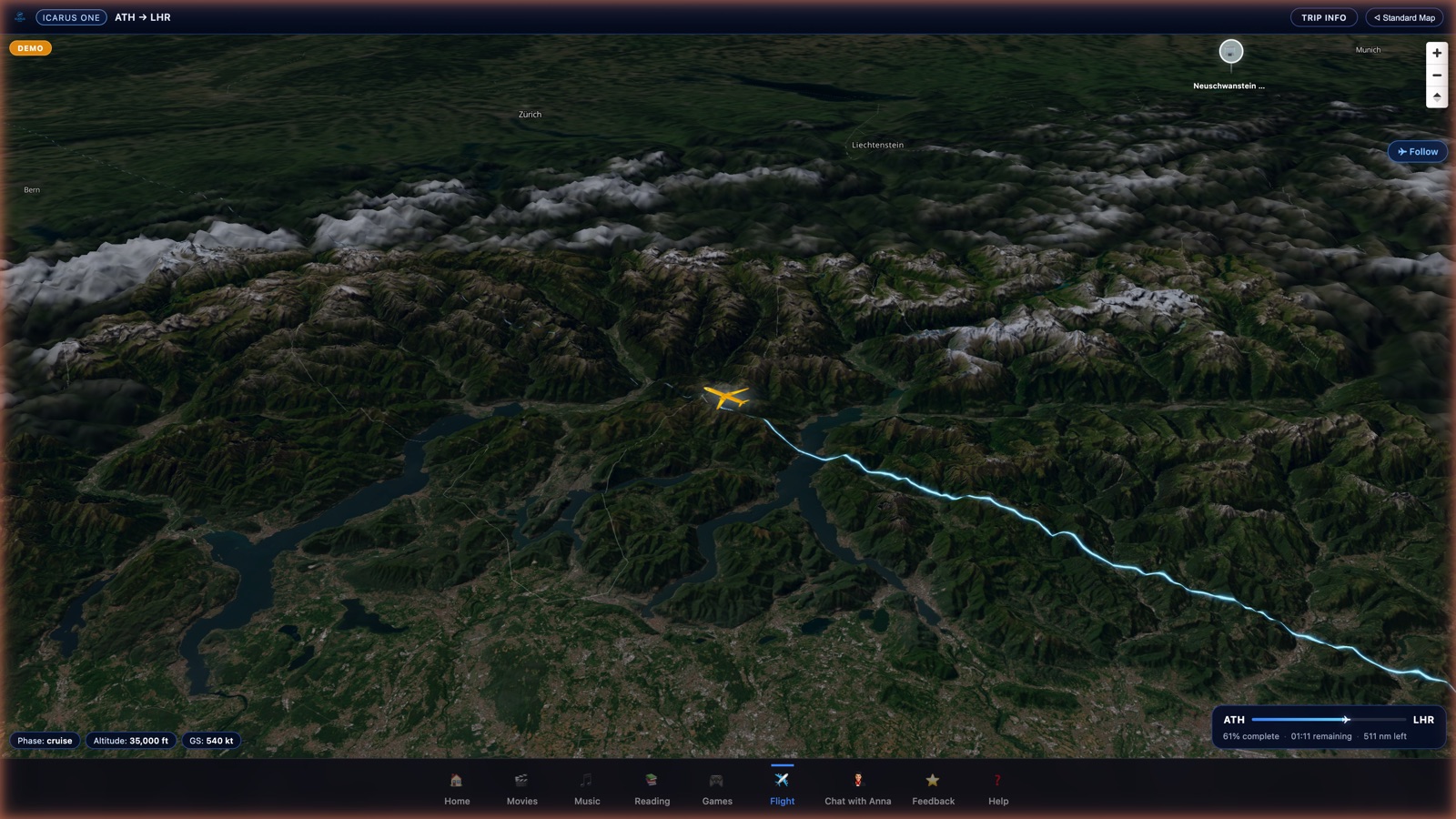
Navigation bar, camera switcher, compass, flight progress bar, and entertainment links — all visible.
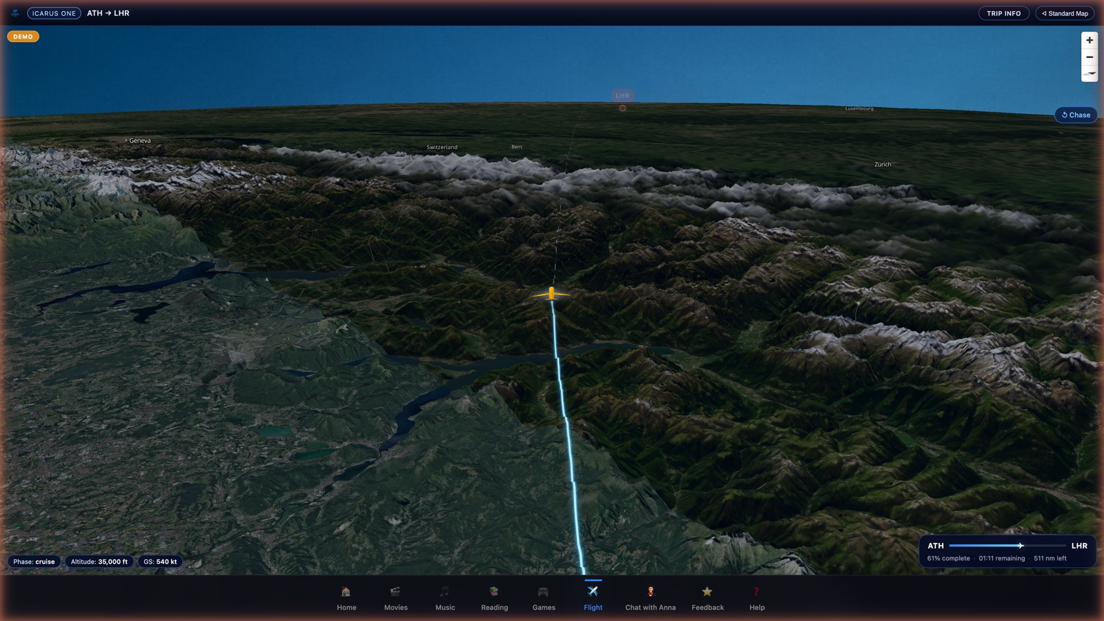
Passengers tap one button to switch camera angles. The entertainment menu is always one tap away.
Operators will select their aircraft type from the admin panel. Passengers will see a 3D model matching the aircraft they’re flying on. Currently, Atlas uses a precision 2D aircraft marker with altitude-based shadow rendering.
Private jet & ultra-long-range
Regional airlines
Narrow-body & BBJ
Wide-body airlines
Ultra-long-range & VIP
Custom fleet configured on request
Current system uses a precision 2D aircraft marker with altitude-based shadow rendering.
Your passengers' faith doesn't stop at the boarding door. Atlas includes Approximate Qibla Direction — because respecting your passengers is a feature, not an afterthought.
Live bearing indicator calculated from aircraft position. Available on equipped routes.
Anna supports 14 text-conversation languages and voice in ten; Hindi, Urdu, Japanese, and Turkmen are text-only.
Terrain tiles from pole to pole. Every route, every continent, offline.
Everything runs on-device. No internet, no streaming, no buffering. Just real satellite terrain on real flight data.
Looking for competitor comparisons, 5-year TCO, or deployment specs? See the full Atlas Technical Overview →
Read the story behind Atlas: In-Flight Maps Haven't Changed in 20 Years. We Just Changed Them.
Official announcement: Icarus Atlas Press Release
Every element is customizable from the admin panel — airline logo, theme colors, welcome screens, aircraft type, route configuration, and POI markers.
Logo, colors, and welcome screens customized to your airline identity.
Select your aircraft type, configure routes, set departure and arrival airports.
Power on, place in overhead bin. Passengers connect via Wi-Fi. That's it.
Every Icarus system ships with Anna VFA — an on-device AI that answers passenger questions in 14 languages, with voice in ten. No internet. No cloud. No latency.
Runs entirely on-device. No internet connection required at any point during the flight.
Text conversation is available in 14 languages; Hindi, Urdu, Japanese, and Turkmen are text-only.
Anna knows the route, ETA, altitude, and weather. Passengers ask, she answers.
We'll demo Atlas with your airline's branding, your fleet's aircraft, flying your most popular route — in 15 minutes.
Trusted by charter, VIP, and government operators across six continents • U.S. Patent 10,193,945 • EAR99 Export Classified